Author: Isabel Grijalva
Science is creative, just as music, painting or theater. Science is also an expression of art. Scientists use their creativity and imagination to advance ideas and design research tools that can be applied to study different ecosystems. Particularly in the Galapagos, being creative is not only a quality, but also a necessity, as it allows us to make the most of the scarce resources we have on the islands.
I would like to share with you my experience during a field trip with the CDF Interdisciplinary Fisheries Project. I was able to see and be surprised by all the instruments that have been created in this project to carry out cutting-edge research in and about Galapagos.
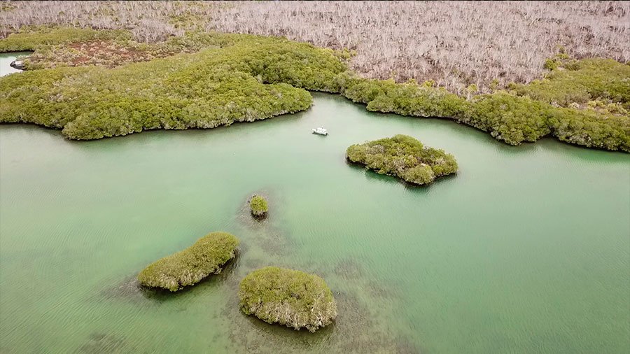
In November 2020, I had the opportunity to accompany project scientist Nicolas Moity on a trip north of Santa Cruz Island at the site of Caleta Tortuga Negra. The objective of this trip was to characterize the structure and composition of the mangrove, as well as to estimate the amount of carbon retained in these plants, through the measurement of the mangrove biomass and the carbon present in the soil of a pre-established plot. Also, the rate of production and decomposition of mangrove leaves was measured to better understand their functioning. In addition, we were able to take censuses of marine fauna with underwater cameras and take aerial photographs of the mangroves, using a drone. All this to study and better understand one of the key ecosystems for the Galapagos fisheries.
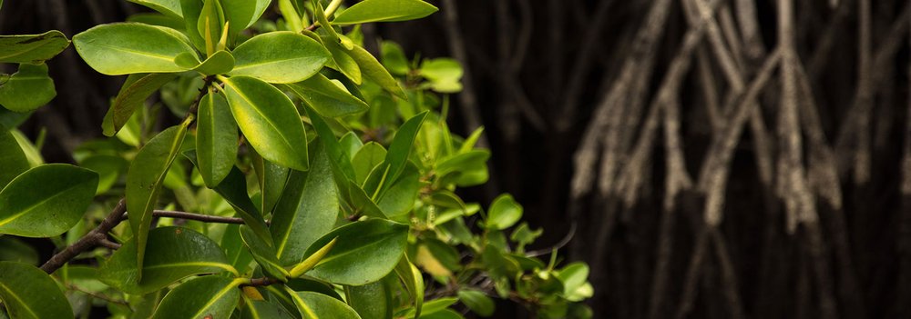
Recent studies (Moity et al., 2019) show that the Galapagos has approximately 3,700 hectares of mangroves around the entire archipelago, which cover 35% of the coast, and which store 778,000 tons of carbon in the sediment (Tanner et al.,2019). In Galapagos, we have four species of mangroves, White Mangrove (Laguncularia racemosa), Black Mangrove (Avicennia germinans), Red Mangrove (Rhizophora mangle) and Button Mangrove (Conocarpus erecta). According to the recent study by Moity et al. (2019), mangroves in Galapagos have increased their coverage by 24% in a period of ten years. This showed that Galapagos is one of the few places in the world where mangrove forests have increased naturally, without human intervention.
Moity explained that "we need to study the mangroves in Galapagos for several reasons. On the one hand, because they are plants that absorb enormous amounts of carbon dioxide from the atmosphere. The carbon is fixed and stored in their leaves, branches, trunks and roots and finally in the soil, reducing the amount of CO2 in the atmosphere, one of the main gases causing the greenhouse effect. Therefore, mangroves contribute to mitigate climate change.
On the other hand, mangroves are important because they protect the coasts from erosion, tsunamis and storms. But the most incredible thing is that they transform the rocky coastline, mainly formed from sterile volcanic lava, into a unique habitat, full of life, and a perfect transition between the land and the marine realms, where a large number of birds, sea turtles, fish (including sharks and rays and edible fish), mollusks, their larvae and the larvae of many other marine organisms that live in the Galapagos Marine Reserve live.
In fact, the mangroves are considered the 'nurseries' of many baby fish, as they live here for the first few years of their lives, they find food, protection from predators and stable conditions that allow them to grow.
They also provide nutrients to other marine ecosystems and are important for tourism, both directly through mangrove sites and indirectly as nurseries for sharks and fish species that are found in the rocky reefs as adults. Mangroves provide a multitude of ecosystem services".
About our research trip
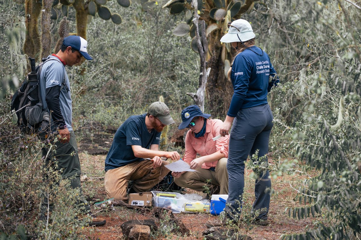
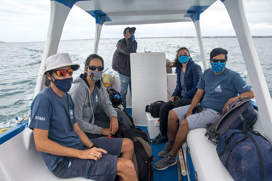
To make the most of our day, we left very early in the morning from Puerto Ayora to Itabaca, where a boat and its captain Don Leo Ayala were waiting for us. We were accompanied by Juan Manuel García, an audiovisual producer from CDF's communications department, Wilson Rivadeneira, a Galapagos volunteer from the interdisciplinary fisheries project and Carolina Carrión, CDF scientist who would be operating the drone.
Don Leo took us to Caleta Tortuga Negra, a beautiful enclave with mangroves where we initially placed two submerged aquatic cameras at strategic points to study fish diversity and abundance in the absence of human disturbance.
The monitoring plot has been pre-established on previous trips by Nicolás to sample and measure forest structure, biomass, leaf production, decomposition, and soil sampling. To get to the plot, we first walked through the famous Galapagos a'a lava. By the way, this lava is very sharp and extremely painful if you slip and fall. When we arrived at the mangrove, we had to perform acrobatics to be able to penetrate the forest by avoiding the branches and aerial roots, respecting nature and considering that we are in the space of the Galapagos National Park.
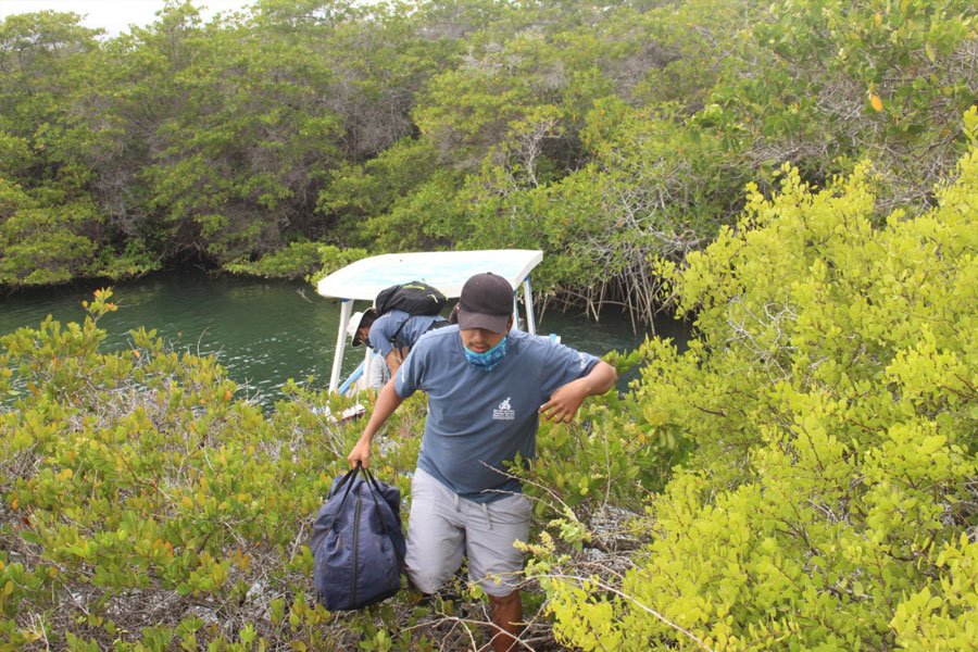
At the start this area was completely strange for me. At first glance, I only saw many branches and aerial roots. But little by little, the more I observed, and with the passing of the hours and research activities, I could understand everything that was happening in our study space.
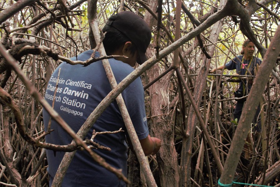
After spending more than 10 hours in this reduced mangrove space, it finally felt familiar. What really surprised me about this trip, though was the creativity of our scientists, Nicolas and Wilson in order to adapt to local resources and achieving top-notch research.
How do you measure a mangrove, the carbon it stores, what equipment are needed?
As it is impossible to study the mangrove forest in its entirety due to how large the forest is, for its study random plots are defined (usually 100 m2 plots) within which a series of characteristics are measured that will serve to estimate the structure of the forest and the carbon stored. These samples will allow the results obtained to be scaled up to the whole forest. Within the plot it is necessary to measure all the carbon pools, i.e. the different carbon stocks in the forest: the carbon contained in the living biomass (trunks, branches, leaves) and the dead biomass above the ground (leaf litter, fallen wood); as well as the living biomass below the ground (roots and rhizomes), and the carbon below the ground (soil organic matter and dead plant tissues). For this reason, during the study day, we carried out different activities that tried to estimate the carbon content of each of these reserves, for which it was necessary to prepare and build specific artifacts and instruments. I describe each of them below:
1. We began by identifying the species of mangrove present in the plot, marking all the trees and assigning them a code, measuring their height and diameter with handcrafted materials and instruments.
Materials: Tape measure + telescopic PVC pipe + pole + aluminum plates + wire + colored ribbons.
Result:
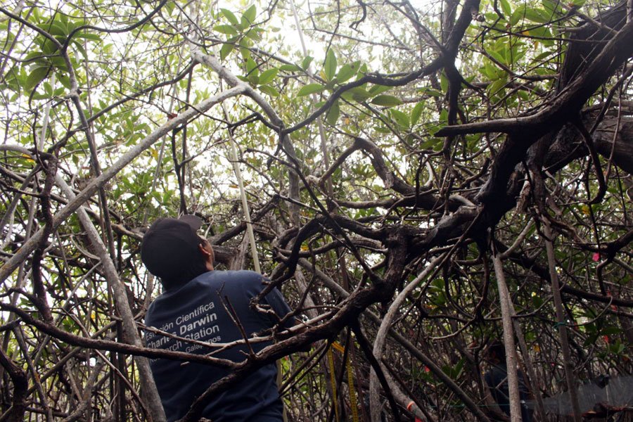
2. We then took samples of the mangrove sediment (soil) with an instrument invented and built by the research team, which is intended to resemble a Russian peat corer. This device allows soil samples to be taken to any depth, without much effort. However, in our case, a PVC pipe, a mallet to stick it in the sediment and cut the roots, and a plunger made of the sole of an old shoe are used to extract the contents of the pipe, once the corer is extracted from the soil.
Materials: PVC pipe + metal rod + old shoe + hammer + wood + old tire tube (to seal the tube and make a 'vacuum' effect when extracting the corer from the soil)
Result:
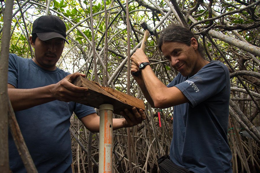
Obtaining the mangrove sediment
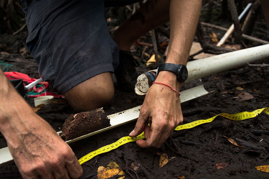
3. We measure the soil depth at 24 points within the plot with a fine metal rod that is inserted into the soil until it reaches the bedrock.
Materials: Metal rod + tape measure + wood.
Result:
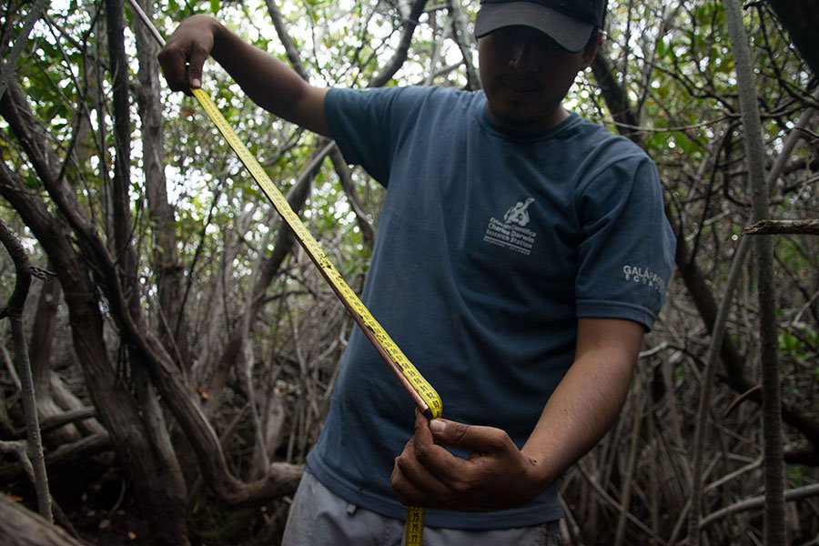
4. To estimate the dead biomass on the ground, we measured the dead trees and the branches fallen on the ground along four 10-meter transects established in four compass directions (45°, 135°, 225°, 315°). This activity was a real challenge since the roots of the mangrove form a real labyrinth that makes mobility very difficult.
Materials: tape measure, string.
Result:
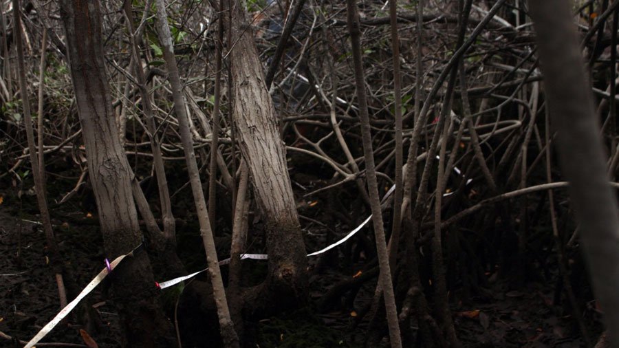
The center point of the plot is marked, and four 10-meter transects are placed in each direction with the tape measure.
5. We also collected the leaves, flowers, fruits, and twigs fallen on the ground in 0.25 m2 quadrants to estimate this component in the mangrove carbon pool.
Materials: quadrant, recycled ziploc bags, rope.
Result:
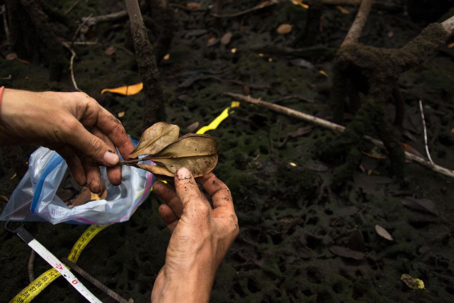
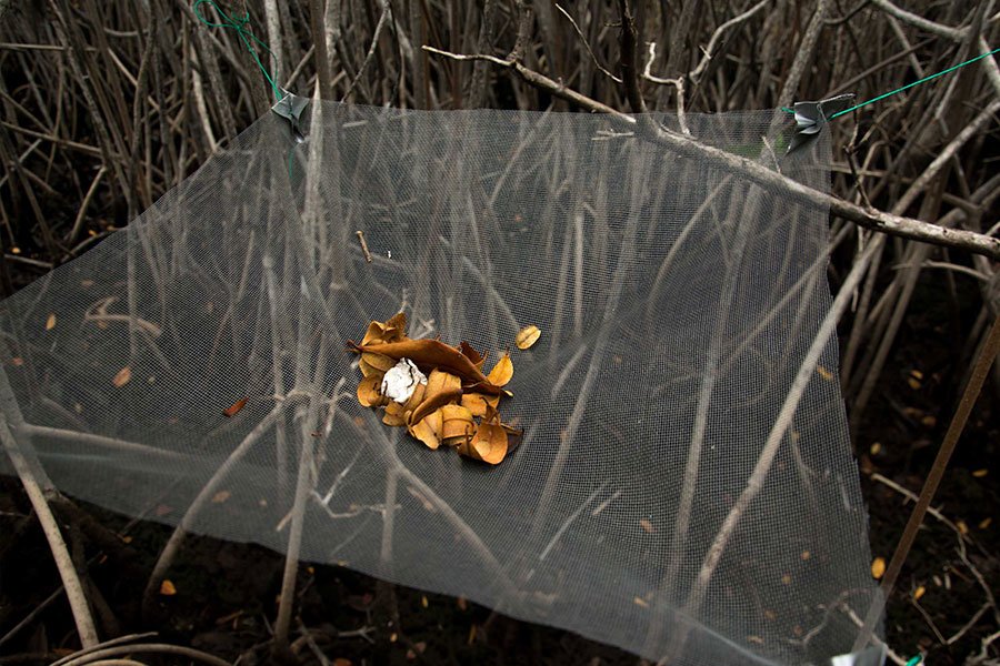
6. Two additional activities were carried out not to measure the carbon produced but rather to understand the functioning of the mangrove ecosystem. On the one hand, the production rate of leaves, flowers, bracts, fruits, and branches of the mangrove is measured by collecting everything that falls into 0.25 m2 traps previously placed by the scientist within the plot at a height greater than the maximum tide. In this way the production of leaves, flowers, fruits, etc. can be calculated and analyzed monthly throughout the year by species.
Materials: Recycled Ziploc covers, trap made of mosquito netting, lead tape, string.
Result:
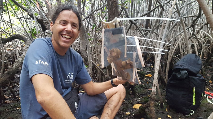
7. Finally, I describe the invention that in my opinion is the most creative. This instrument, complementary to the previous one, would help us measure the rate of decomposition of mangrove leaves, as a measure of the contribution of nutrients and organic matter from the mangrove to the marine ecosystem. To do this, Nicolás placed a known quantity of dry leaves in small cases made with handmade mosquito netting (placing several replicas per species), at the base of the trees. This experiment requires returning at regular intervals to measure the rate of decomposition.
Materials: Mesh + PVC pipe + Velcro + plastic handles.
Result:
The eight small sleeves with dry leaves were placed between the roots of a mangrove.
We hope to return very soon to discover the results of these wonderful inventions. If you would like to learn more about our next field trip and follow the study of mangroves, climate change, and fisheries in Galapagos, visit and support the project with your donations.
